Michigan Spearfishing Boundaries
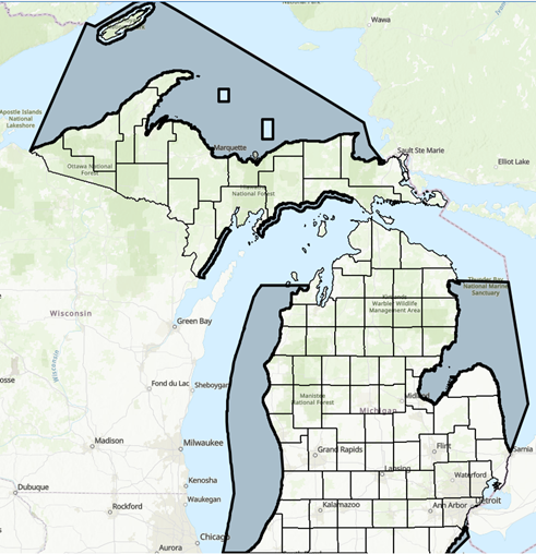
New 2026 Michigan Boundaries
Exception: It is unlawful to fish with an underwater spear for northern pike, lake trout and walleye in the following waters:
Stannard Rock (east of a line of longitude at -87.28 degrees, south of a line of latitude at 47.27 degrees, west of a line of longitude at -87.11 degrees, and north of a line of latitude at 47.13 degrees)
Big Reef (east of a line of longitude at -86.55 degrees, and south of a line of latitude at 46.93 degrees, and west of a line of longitude at -86.37 degrees, and north of a line of latitude at 46.7 degrees)
Within a 4.5-mile radius of Isle Royale
Where Can You Spearfish in Michigan?
Click the link below to download a .gpx file of the new 2026 legal spearfishing boundaries in Michigan.
You’ll need to upload this file to a GPS app to read it. It will overlay the boundaries onto a map. I like Gaia GPS, some people like onX. If you need a KML or geoJSON file, send me a message.
Those boundaries are for planning purposes only and not legally verified.
The new 2026 regulations only permit the harvest of walleye, lake trout, and northern pike in the following designated areas:
Lake Erie:
Waters north of the Michigan/Ohio border northward to the mouth of the Detroit River (line extending due east and west of the most southerly point of Celeron Island)
Lake Michigan:
Waters north of the Michigan/Indiana border northward to the 45th Parallel excluding all waters of Grand Traverse Bay
Waters from the Michigan/Wisconsin border northward to the southern edge of the mouth Ford River (45.673512, -87.143475) extending out 5 miles from shore
Lake Michigan from Point Detour (southernly point of the Garden Peninsula) eastward from the west edge of the mouth of the Brevort River, extending out 5 miles from shore
Lake Superior:
All Michigan waters from the Michigan/Wisconsin border eastward to the St. Mary’s River (Birch Point Range front light to the most westerly point of Round Island, thence following the shore of Round Island to the most northerly point thereof, thence from the most northerly point of Round Island to Point Aux Pins light, Ontario)
Lake Huron:
Waters south of the southernmost pier of the Thunder Bay River, extending south to the mouth of the St. Clair River (Fort Gratiot Light)
You’re permitted to spear non-game species on the Great Lakes and on inland lakes, streams, and rivers that are not designated trout waters.
Where To Find Fish
Like every creature of the wild — seasons, weather, and forces out of our control and comprehension influence where they go and when. Fortunately, there is plenty of preexisting literature on how and where to find these fish species. But, traditional anglers don’t care about how deep their quarry lives, we do.
The tips below are focused on finding fish at depths that spearos can target (0 feet - 120 feet). Remember, a fish will do what it want, when it wants — we’ve seen Lake Trout in 20 feet of water in July and Whitefish in 5 feet of water in August. The only way to find fish, is to get in the water.
You’ll find species-specific spearing tips below. In addition, the following tips apply no matter what you’re after:
Structure
This is the first place you should start. This could be a pier, old dock pilings, shipwrecks, break wall, riprap, rocky shoals, or a navigational buoy.
Water Visibility
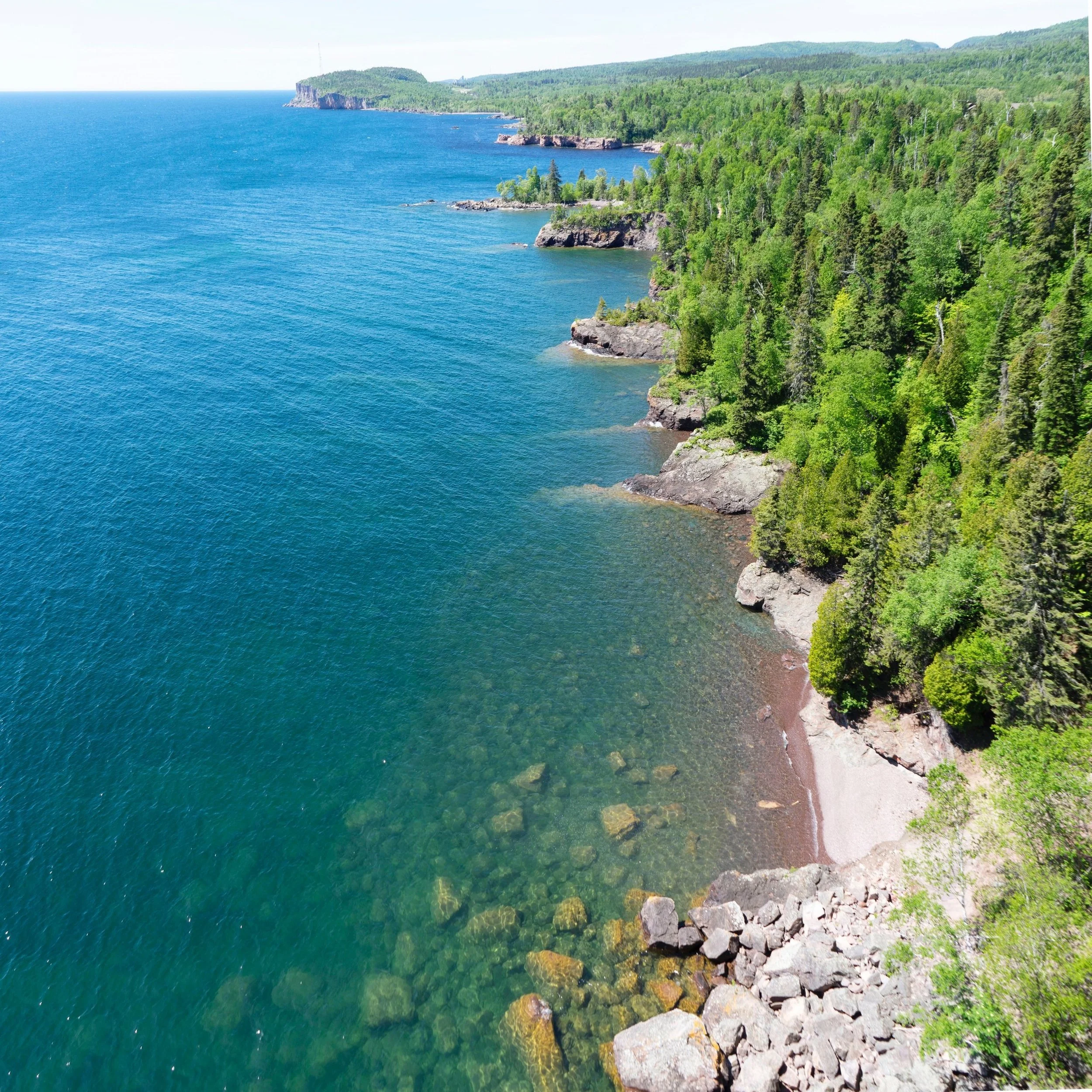
Generally, the further north in Michigan you dive better the water visibility is. Yeah, it’s nice diving with more visibility, but diving with 2-3 feet visibility is still worth it, you’d be surprised what comes up to check you out.
Terrain
Technically, bathymetry….I think. Benches, shelves, ledges, dropoffs, pinch points, shoals, reefs. Whatever you call it, make sure you can find it ‘cause that’s where the fish are.
Vegetation
Many fish species like weed beds. Lake weeds, sea grass, algae—the greener, spookier, and thicker, the better.
Water Temperature
You’ll need more than just the surface temperature. Get familiar with the Great Lakes Bouy Portal and glean information from the bouys that provide water temperature beneath the surface at different depths. Fish like thermoclines, learn which temps they like and how deep you have to dive to get there.
Spawning Seasons
Spearos should become familiar with when their species spawns. Generally, fish move into shallower water to spawn which can provide easier opportunities to spear fish that traditionally hang out in very deep waters.
How to Find Fish to Spear
-
For most times of the year, you’l find trout in deep, cold water. Lake Trout spawn in the fall which is when you can find them in shallower (30-50 feet) waters. DNR species information.
-
You’ll find walleye on benches, dropoffs, and ledges. This includes rocky points, islands, reefs, shoals. Anywhere you can find deep, cool, still water, you can find walleye. DNR species information.
-
Cabbage dinosaurs inhabit shallow weed beds and warmer water near the shoreline. DNR species information.
-
Freshwater drum like eating zebra muscles. You can find these rugged critters in a variety of habitats and at depths.
-
Whitefish can show up when you least expect them. They typically travel in large schools in the cold, dark depths of the lake. They spawn in shallower waters in November/December which is the best chance to spear them.
-
Carp are everywhere. Go spearfishing nearshore around some structure and you will find them.
-
Catfishing like slow-moving water near structure. Look for sluggish slack water, pools, and submerged debris.
-
Burbot live in the water.